The Antarctic Programme
The Antarctic is changing. Climate change, ocean acidification, changes in land and sea ice, and increasing human activity both on the continent and in the oceans outside, are contributing to these changes. Better knowledge of ongoing changes and the mechanisms that control these is necessary to be able to predict the changes that nature and society will face in the years ahead.
Through monitoring and research, the Antarctic Programme will produce data and knowledge as a basis for advice to the administration on the geology, climate, nature, ecosystems and environmental development in the Antarctic.
The geographically most important areas for the Antarctic Programme are Dronning Maud Land, Kong Håkon VII Hav, Bouvetøya and the sea areas around Bouvetøya, but also other areas in which the Norwegian administration has special interests.

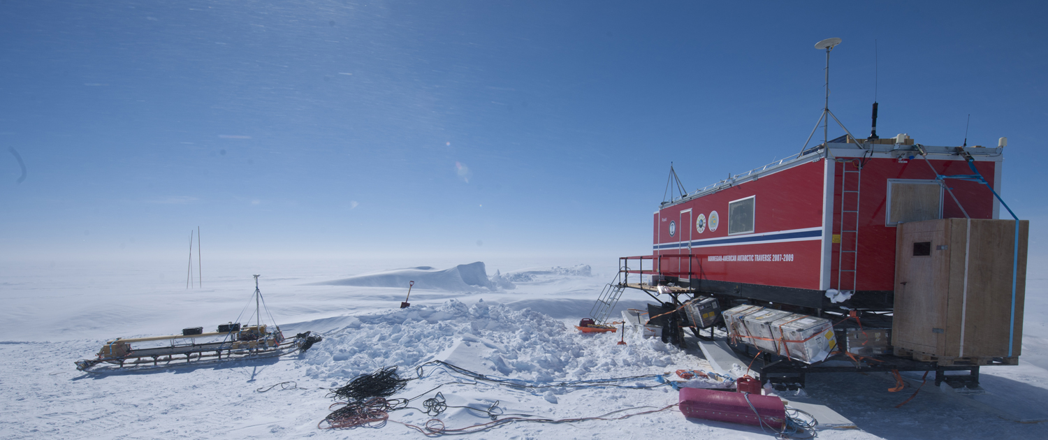
Studying the mass balance of Fimbulisen. Photo: Elvar Ørn Kjartansson / Norwegian Polar Institute
Monitoring
1
2
Fast-is-overvåking
1
Mass balance glaciers
More info is coming.
3
4
Projects
1
2
3
1
Dome Fuji
This project investigates the deepest ice sheet in Antarctica (Dome Fuji), the oldest atmospheric gas archive in the world, primarily by analyzing ice radar data. This region likely has ice that is about a million years old.
3
4
The New Ålesund Programme
Through the research and environmental monitoring activities that have been the foundation of the Norwegian presence in Ny-Ålesund since the late 1960s, Ny-Ålesund Research Station today stands as a unique high-Arctic location that contributes many of the most important biological, atmospheric and physical data time series that are part of the global knowledge commons.
The extensive practical and logistical support offered in Ny-Ålesund makes it possible to conduct research and environmental monitoring at a high professional level, with a strong focus on safety in the field, and in a cost-effective manner.
The Ny-Ålesund Programme is responsible for ensuring that the Norwegian Polar Institute properly exercises the hosting role, and implements the research strategy for the Ny-Ålesund Research Station.

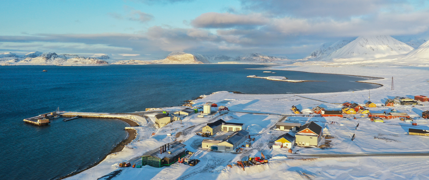
Ny-Ålesund Research Station. Photo: Trine Lise Sviggum Helgerud / Norwegian Polar Institute
The Arctic Ocean Programme
The Arctic is changing rapidly, with rising temperatures in the ocean and atmosphere and decreasing ice cover. Ecosystems and human activity in the area are also changing. Better knowledge of the ongoing changes and the mechanisms that control these is necessary to be able to predict the changes that nature and society will face when most of the Arctic Ocean soon will be ice-free for parts of the year.
Through monitoring and research, we produce data and knowledge to advise management on the status, variability and development trends in climate, natural environments and ecosystems, and on the drivers of these changes. The knowledge provides the basis for advice to authorities for use in national ocean management and internationally (working groups in the Arctic Council, IPCC, etc.), and is disseminated in scientific forums and to the general public.
The geographically most important areas for the Arctic Ocean Programme are the northern ocean areas where Norway has a special responsibility for management; the northern Barents Sea, the Fram Strait and the Nansen Basin, and the interaction between the ocean and the coastal areas of Svalbard.

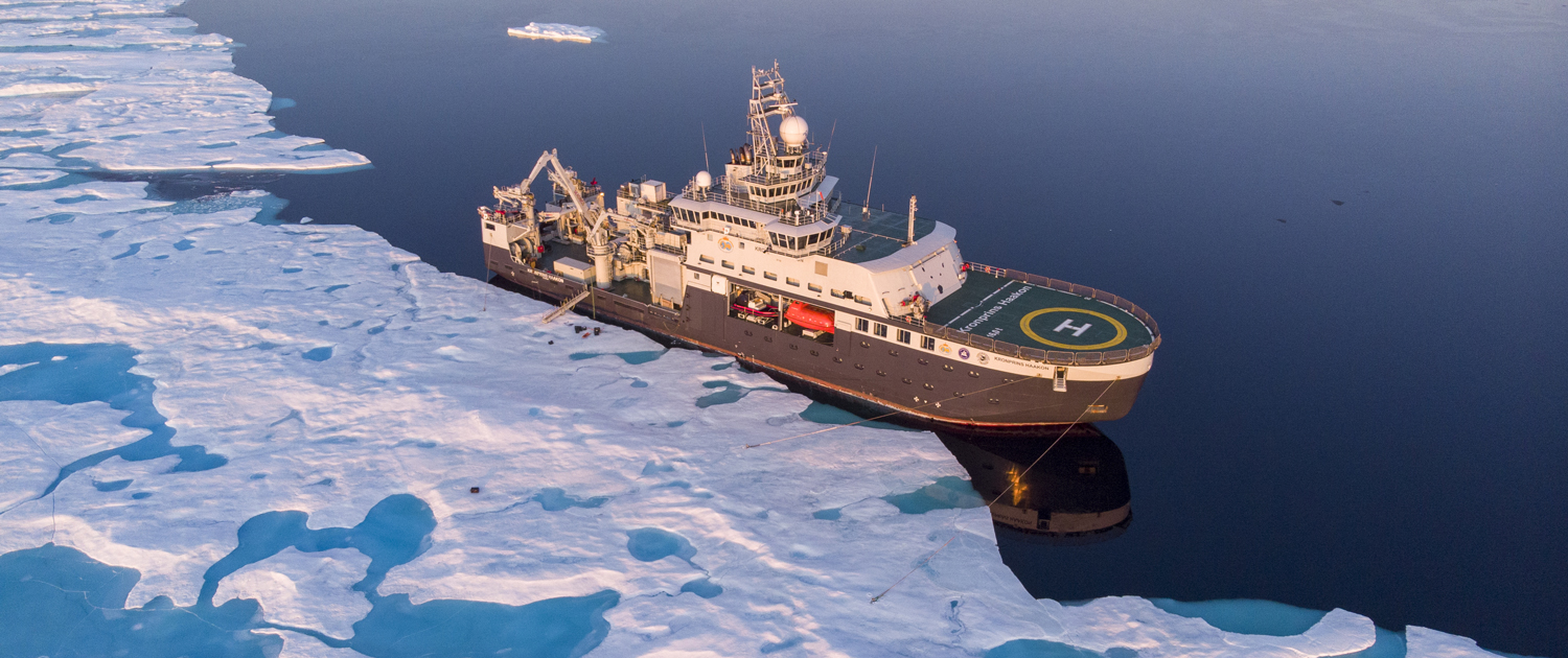
The research vessel Kronprins Haakon in the Arctic Ocean. Photo: Lawrence Hislop / Norwegian Polar Institute
Monitoring
1
2
Overvåking i Polhavet (SUDARCO/Atlantic-DBO)
More info is coming.
Sjøpattedyr og marint lydbilde/PAM
More info is coming.
Projects
1
2
3
4
5
6
1
2
3
Seabird trecking
More info is coming.
EU HiaHOOS
More info is coming.
The Svalbard Programme
Svalbard is the place on Earth where the temperature increase is currently the fastest. The physical changes that result from this affect the ecosystem, infrastructure and human activities in this region. This in turn changes the risk levels for endemic flora and fauna and their habitats on land and at sea.
Through mapping, monitoring, research and international cooperation, the Svalbard Programme produces data and knowledge as a basis for advice to management on the geology, climate, ecosystems and environmental development in Svalbard. The programme also contributes input to larger Arctic and global conservation work processes (such as the Arctic Council, OSPAR, IUCN and others).
Activities take place across the archipelago, with key locations around Longyearbyen, Ny-Ålesund and research locations at small stations on islands in the north and south-east.

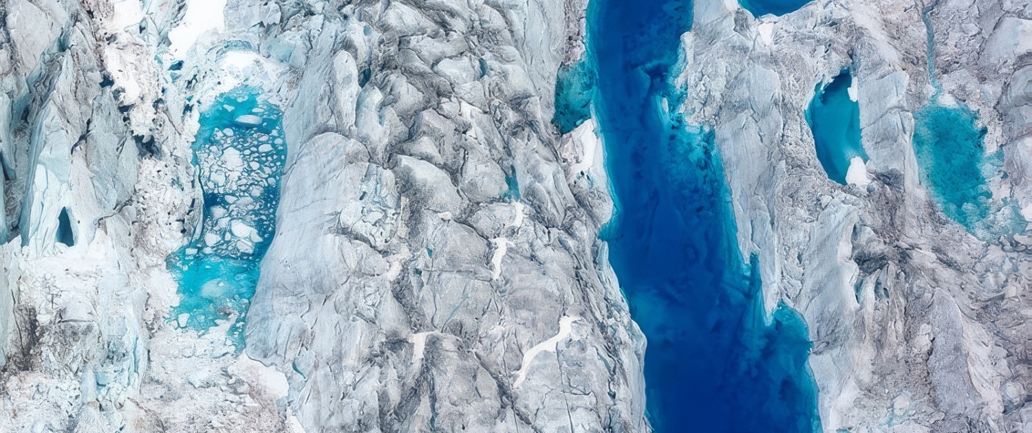
Glacier with melt ponds and crevasses. Photo: Samuel Martínez Llobet / Norwegian Polar Institute
Monitoring
1
2
Miljøprøvebanken
More info is coming.
Sjøis i kystområder
Pelagisk sesongovervåking i Kongsfjorden
More info is coming.
3
4
5
Projects
1
2
3
1
2
Metallica
More info is coming.